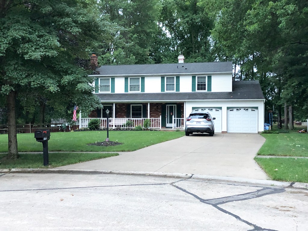
The 2013 coming of age comedy “The Kings of Summer” was filmed entirely in Northeast Ohio. Joe Toy, played by Nick Robinson, lives with his father Frank, played by Nick Offerman, at this house located in the town of Lyndhurst. After some family disagreements, Joe and his friends decide to leave and build their own home out in the woods.

LOCATION: 4867 Edsal Dr, Lyndhurst, OH 44124
The Chagrin River is seen several times in the film as Joe rides his bike down Cleveland St. In another scene, the boys are walking through the water.

LOCATION: 218 High St, Chagrin Falls, OH 44022 (as seen from Cleveland St)
Joe attends school in Chagrin Falls. The high school and middle school are on the same property and the area seen in the film is actually the middle school at the rear of the property.

LOCATION: 342 E Washington St, Chagrin Falls, OH 44022
Patrick, played by Gabriel Basso, lives with his parents at this home in North Royalton.
LOCATION: 13940 Quail Oval, North Royalton, OH 44133
The pipe where the boys drum with broken tree branches and dance was featured prominently, both in the film itself, as well as the marketing campaign leading up to its release. While it appears to be a remote location, the spot is not as difficult to find as you might expect. It can be found in Whitesburg Park in Chagrin Falls. We’ll explain how to reach it.
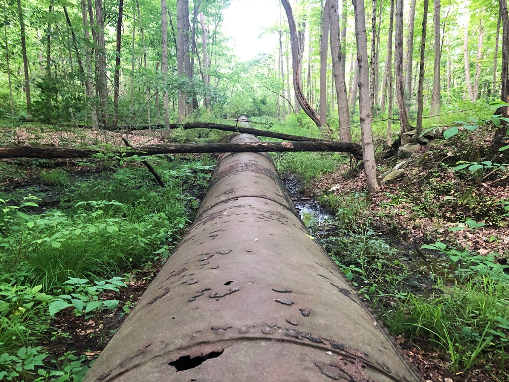
LOCATION: Whitesburg Park, Chagrin Falls, OH 44022 (GPS coordinates approximately: 41.440071, -81.380063)
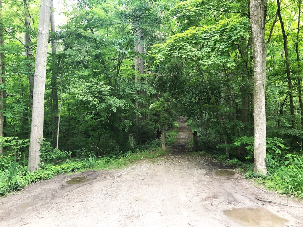
These final two photos are not shown in the film itself, rather they are included here in an attempt to illustrate how to get to the above location. To reach the pipe, you simply drive down High St, which is initially a paved, residential street. If you continue down it, the road becomes unpaved and will lead you straight to the trailhead. It’s not a particularly far drive and there are some unmarked parking areas available. The ground can get muddy, however, so be mindful of weather conditions. If you take the road until it dead ends, you’ll be pretty close to the right spot. There’s a couple different trails in that vicinity. The one pictured below is on the left side, just before the road dead ends. This is what the trailhead looks like on the ground, the GPS coordinates are approximately 41.439869, -81.380259. If you proceed ahead on the trail, the pipe would be in the woods on the right side and you can start to see it pretty quickly.
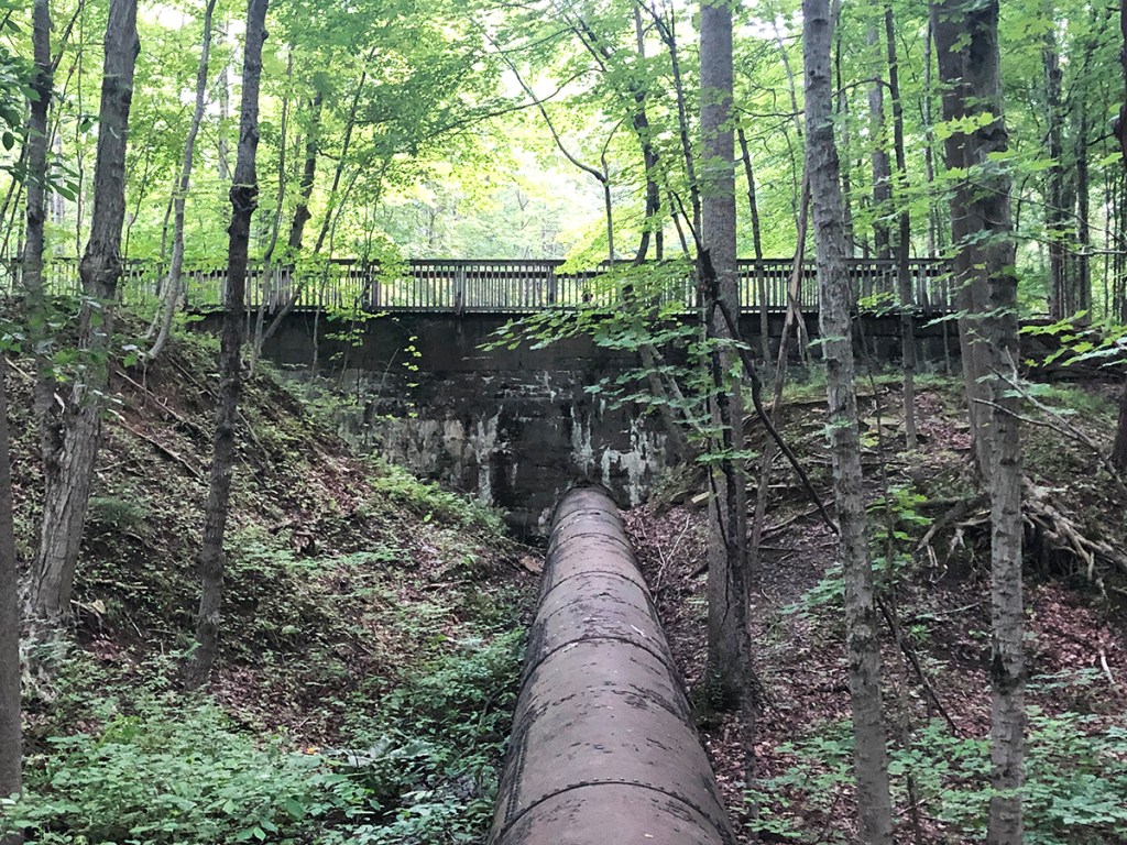
However, the easiest way to identify it is by simply continuing straight up the trail until you reach this pedestrian bridge. It is only a couple minutes walk from the trailhead and it directly overlooks the area of the pipe where the scene was filmed. It is a good spot for photography and recommended to those not wanting to wander off the trail. The park seemed safe from our experiences, with many people from the community out walking the trails. The pipe is within sight of the main trail, so you don’t need to walk far to reach it. However, going off trail of course presents possible hazards, such as loose debris on the ground or any of the usual risks involved in roaming around the woods, so proceed at your own risk.

This is one of my favorite movies and I don’t live too far from there it was filmed, so thank you for being so detailed in how to visit the locations!
LikeLike