The 1965 Russ Meyer film “Faster, Pussycat! Kill! Kill!” was shot in the deserts of Southern California. The film maintains a cult status and continues to find new fans decades after its release.
The opening go-go dancing scenes were filmed at the Pink Pussycat Club in West Hollywood, which was formerly located at 7969 Santa Monica Blvd, West Hollywood, CA 90046. Some resources state the scenes were filmed at The Pussycat Club in Van Nuys, but that information appears to be incorrect.
There is also conflicting information about the location of the salt flats where the car race takes place. It was once claimed to have been shot at a place called “Lake Cunniback,” but no such location seems to exist. Other resources suggest Rosamond Lake in Rosamond, California, but it remains subject to debate.
One location that remains in tact is the gas station where the three women fuel up. The gas pumps have been removed, but otherwise the buildings, located in the small town of Randsburg, still appear very much the same as they did in the film.

LOCATION: 26623 Butte Ave, Randsburg, CA 93554
Here is the location where the old man and his son park their truck. The women learn the old man may have a large sum of money hidden at his ranch and quickly decide to try to find it.


The Old Man’s ranch, where much of the film takes place, was known as Ollie Peche’s Musical Wells Ranch in the town of Mojave. The ranch was abandoned for years and remained standing until at least 2017, where visitors could approach and explore it. The land was eventually purchased by a motorcycle driving school and the owners decided to demolish the ranch. Here is an aerial view of where the ranch once stood. The surrounding wall still exists.
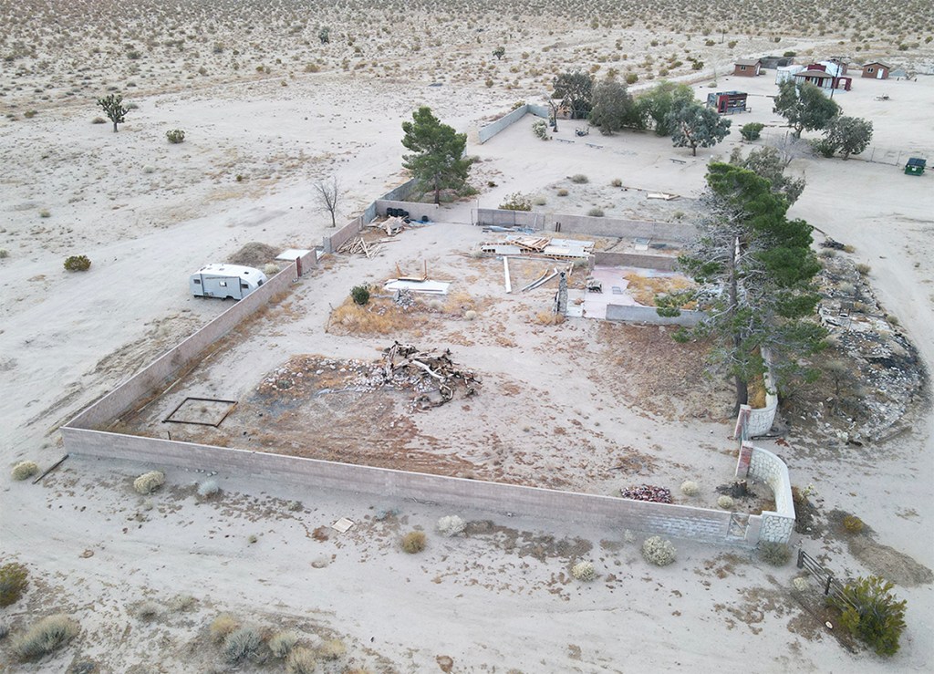
LOCATION: 1600 Pesch Blvd, Mojave, CA 93501 (now demolished)
From ground level, the land is fenced off and marked as private. To reach this area, you must take CA-14 N to Leman Rd. From Leman Rd, you turn right and make an immediate left onto Pesch Blvd, which is marked with a street sign. Pesch Blvd is paved and you can take it straight down until it reaches the fencing and private property signs. You can continue by turning right along Pesch Blvd, but you can’t proceed any further onto the land, which is where the ranch was located. Below is a photo of the closest point you can now access from ground level before the private markers. There are some photos available online from when the ranch still stood.


That would be “Cuddeback Lake”, a dry lake about 15 miles southeast of Randsburg, CA.
LikeLike